Mt. Hapunang Banoi, Rodriguez Rizal


Mount Hapunang Banoi, Brgy. Wawa Rodriguez, Rizal, Philippines

Mount Hapunang Banoi is one the beautiful mountain in Rizal province, Philippines. It is situated at Brgy. Wawa, Rodriguez, Rizal. According to the locals Banoi is the tagalog word for eagle where used to dine in this mountain from the past. Mt. Hapunang Banoi has its neighbor mountains such as Mt. Binacayan and Mt. Pamitinan which is also located at Brgy. Wawa and Mt. Ayaas and Mt. Sipit Ulang in Brgy Mascap, Rodriguez, Rizal. Hikers can try Twin hike (2 peaks in one day), Trilogy (3 peaks in one day) or even Pentalogy (5 peaks in one day) if you are a hardcore. According to PinoyMountaineer, had a minor specification with 4/9 difficulty level, it also features different limestone formations, scenic views of Sierra Madre and Rizal province.

Mount Pamitinan and Mount Binacayan
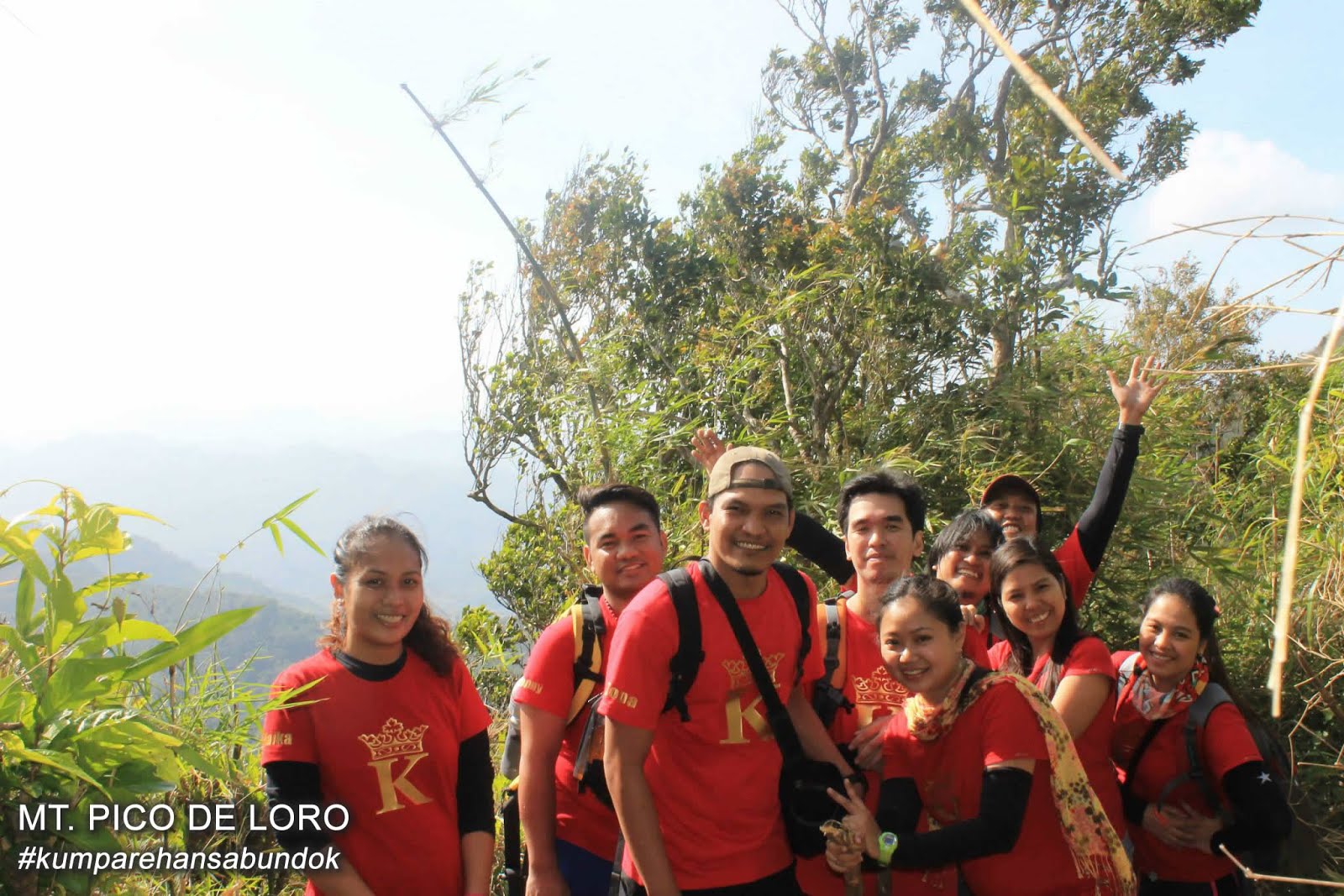
THE GROUP

This time it's a friendly climb between Munting Hikers and Kumparehan Mountaineer (actually we're just joiners). We suggest to them that if we can finish early, we will proceed to Mt. Pamitinan for a possible twin hike. But some are not ready for twin hike and to think also that we have no idea what pace of everybody during the trail. Our group is consist of 24 people so we hired 3 guides for our group. Actually it cost 500 pesos/guide/mountain for every 5 person but still negotiable between group and the guides.

 Munting Hikers and Kumparehan Mountaineer
THE TRAIL

They say that 90% of the trail is rock. But for us it looks like 1/4 of the trail is just like an ordinary trail of other mountain until you reach the junction. The junction is the part of the trail were the route will separate if you're heading to Mt. Hapunang Banoi or Mt. Pamitinan. You may also take your rest for a while or even eat your foods or buy drinks in a sari-sari store in the junction before heading to the summit.

Wooden hanging bridge


Start the trail going to the summit


You will enjoy the epic view as you become closer into the summit. thank God for the beautiful weather.


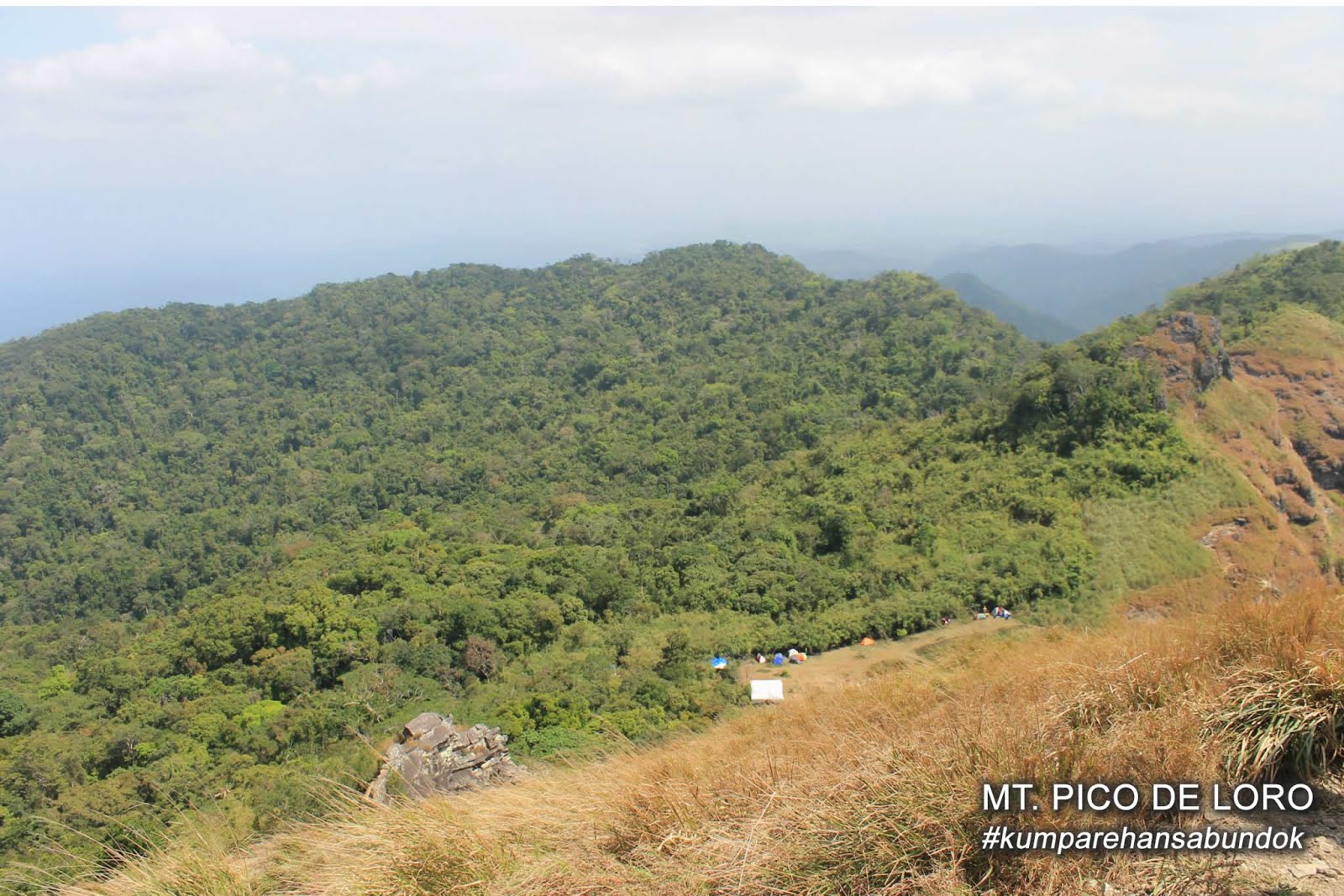
Finally we reach the summit and saw the breathtaking view of top of the mountain.


Side trip in Wawa Dam after we finish the  hike. It's good to relax after  the climb.


This is one of the memorable hike we ever had. It is good for the beginners and it's near in Metro Manila.

Mt. Pico de Loro | Mount Palay - Palay | Monolith, Cavite


Monolith as seen from the Parrots Beak

Mt. Pico de Loro also called as Mt. Palay-Palay is the second hike of our group. It is located in the boundaries of Ternate, Cavite and Nasugbu, Batangas. Estimated travel time from Manila to Pico de Loro is approximately 2 and half hours. Hiking specification is minor climb with 3/9 of difficulty as per pinoymountaineer.

If you plan to hike Mt. Pico de Loro, you must have 3 objectives. First is to reach the campsite, second is to climb all the way to the summit or Parrots Beak and finally to get on the top of the famous monolith.

For beginners and nature trippers, this mountain (Mt. Pico de Loro) is the best choice to start. The trail is clearly visible. Tour guide is not mandatory unlike in other mountains, but for beginners we suggest to get one for your group.

The DENR implemented new rules when hiking Mt. Pico de Loro. Overnight camping is not allowed anymore. Cooking, smoking and littering (as always) is also prohibited. Visiting hours is from 4:00 AM up to 3:00 PM. Also they opened the new trail from the DENR registration itself.  They say that the new trail is easier than the old trail.

THE TRAIL

Beginning of the trail


During the trail, you may encounter some fallen old trees caused by the past typhoon.


When you saw a lot of bamboo trees in most of the trail, it is the sign that you are getting closer to the campsite.


CAMPSITE

For about two and half hours we reach the campsite. Before ascending the summit, you can rest, eat, take pictures and enjoy the view at the campsite. From there you will see the summit or parrots beak and a little portion of the monolith. Foods and water are being sold at the campsite, it's a little expensive but you can still afford it.


PARROTS BEAK

Approximately 15 minutes from the campsite is the Parrots Beak. Climbing the summit is a little harder than we thought, It's too steep and slippery.  One wrong step and you will be going down the hill or worse on a cliff.  There are some locals who are offering help to guide you climb the summit. It will cost 50 pesos for each person.

Campsite as seen from the Parrots Beak

Monolith as seen from the summit


MONOLITH

Unfortunately we're not able to climb the monolith due to the high volume of hikers. After spending half an hour waiting in the line, we decided to descend. If you want to climb the monolith, we would suggest that you start your hike and reach the summit as early as possible to avoid the high volume of people in the monolith.


Also, one thing that we observed was the long trail going back to the DENR registration, although it was the same trail that we used to get into the campsite. It's kinda weird but maybe it was just fatigue or exhaustion.


ITINERARIES:

DAYHIKE

0400 Board bus at Coastal Mall Terminal to Ternate (P82)
0700 ETA Ternate. Rent jeepney or tricycle to jumpoff
0745 ETA DENR / jump-off point. (P25 registration)
0800 Start trek.
0945 Reach highest point of the New Trail
1000 Arrival at junction with Old Trail
1030 ETA campsite 
1100 ETA summit. Lunch 

From this point, take either Option A (Backtrail) or B (Traverse)

Option A: Backtrail to Ternate

1230 start descent to Magnetic Hill
1430 Back at DENR; take jeep/trike to Ternate then take bus back to Manila
1900 ETA Manila.

Option B: Traverse to Nasugbu

1230 start descent to Nasugbu-Ternate Highway
1530 ETA Nasugbu-Ternate Highway.

1700 Arrival in Nasugbu. Dinner. Bus terminal is near Jolibee.
2100 ETA Manila.

Itinerary Source: PinoyMountaineer